Slide on North Fork Gales Creek muddies water in Tualatin River
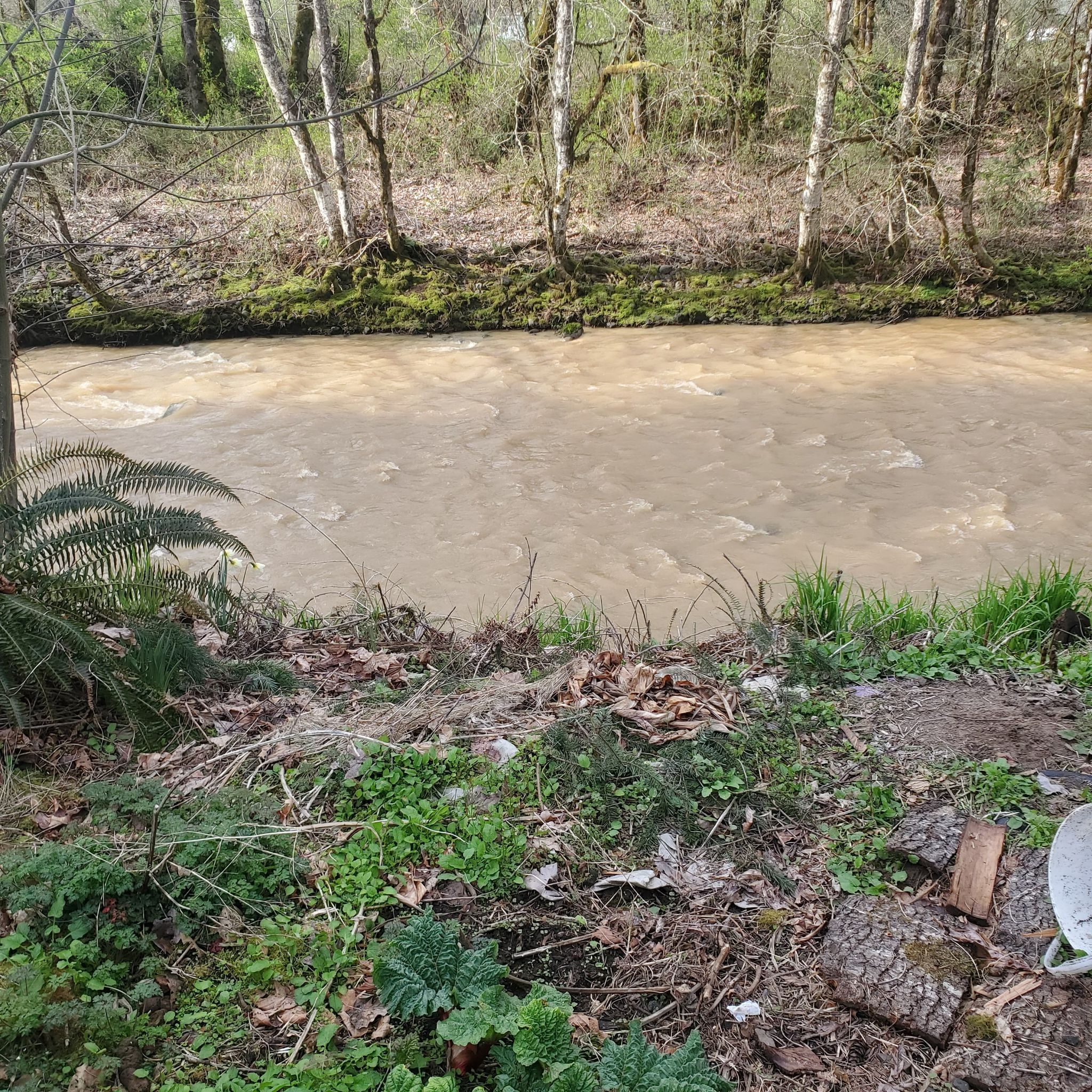
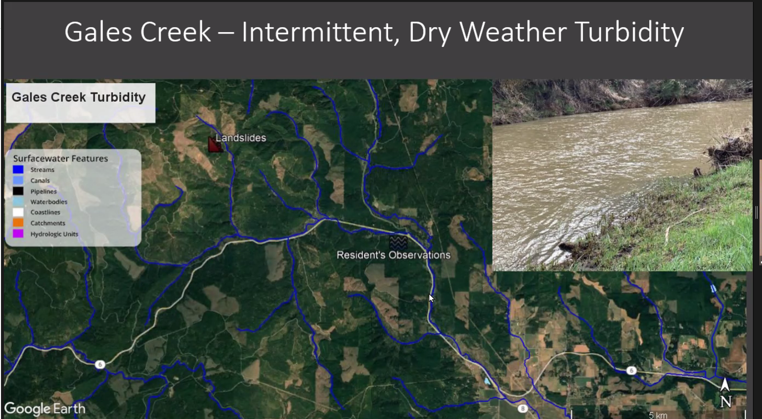
Over the past few weeks, Gales Creek residents have noticed muddy waters in Gales Creek intermittently, even when it wasn't raining. It's believed the likely culprit is a large landslide on North Fork Gales Creek about two miles south of Reehers Camp.

Late in March, residents along Gales Creek began to notice a strange pattern in the waters of the 23 and ½ mile long Tualatin River tributary.
Muddy water was coming down the creek bed when it wasn’t raining, and the muddied waters seemed to pulse on and off.
“The last three work days we can just about set our clocks by it,” Gales Creek resident Sharon Hundley Parker (Disclosure: Parker is this journalist’s mother) said April 7. Parker lives on Gales Creek along the Wilson River Highway.

A hodgepodge of authorities were notified, including the Oregon Department of Forestry, the Oregon Department of Environmental Quality, the Oregon Department of Forestry, with others joining in, trying to get to the bottom of what’s happening.
In a meeting held remotely via Zoom, the Tualatin River Watershed Council, a quasi-governmental nonprofit organization met and discussed the situation during a regular meeting on April 6.
TRWC Executive Director Scott McEwan began the discussion by noting that several Gales Creek residents had reached out to several agencies with “what they were describing as dry weather turbidity, which is not normal,” McEwan said.
Turbidity in the context of water treatment, is usually a characteristic of water that has become clouded with some form of debris—clay, silt, very tiny inorganic and organic matter, algae, dissolved colored organic compounds, plankton and other microscopic organisms, according to the U.S. Geological Survey—and is common during the rainy season.
While large pulses of turbidity were noted by operators at the Joint Water Commission plant, it wasn’t until about two hours later that a slightly more significant event occurred.
“The turbidity itself was actually handled just fine,” Simon Christensen, who works at the Joint Water Commission, said. “The turbidity wasn’t an issue, but the FDOM was what caused us to change operations a little bit,” he said. FDOM—that’s Fluorescent Dissolved Organic Matter for those not immersed in water treatment jargon—requires chlorine to treat.
Plant operators sent staff to look for the issue, and came up empty handed after an informal survey.
Others were searching, too. A handful of Gales Creek residents were in contact with each other and with staff from DEQ and ODF, looking to pinpoint the location, and perhaps a culprit. Speculation that perhaps unpermitted in-water work on Gales Creek was occurring.
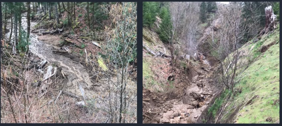
But now, a possible—though not conclusive—cause has been found. A large landslide on Stimson Lumber-owned property on the North Fork of Gales Creek in the Coast Range is clogging the creek bed, depositing huge amounts of mud into the salmon, steelhead, and Pacific lamprey-bearing waters.
Stimson Lumber’s Silviculture Manager Rodney Jacobs described the slide as large, with two originating spots.
“It’s very large, and it’s slipping on a rock face,” Jacobs said, describing it as a near-vertical rock face. “Just sheets of dirt are falling off this rock face and they’re right in the channel, so that’s where the pulses are coming from.”
The area of the slide is roughly 2 miles south of Reehers Camp in Washington County.

Jacobs said that in the week prior to April 6, the slide was continuing to deposit dirt and even trees into the creek. “It’s definitely an active area. So, what to do to mitigate it? That’s a tough question,” Jacobs said “It’s definitely the largest slide I’ve seen in this area in my 23 years with Stimson, so it’s definitely abnormal,” he said.
Jacobs said that no work was being done by Stimson in the area and characterized the slide as natural, a characterization that Tualatin Riverkeepers Executive Director Jan Wilson took issue with.
“Logging is not necessarily a natural occurrence,” Wilson said. “I would say, let’s be careful with the words we use. They aren’t scientific words,” Wilson added.
The area of the slides was the site of logging operations in 2003 and 2012, according to Jacobs.

TRWC’s McEwan noted that more information was needed to determine if anything could or should be done regarding the slide, and noted that officials would try to arrange for a site visit at the slide, possibly to be held Wednesday, April 13.
Gales Creek is considered a major tributary to the Tualatin River, according to the Tualatin Soil and Water Conservation District.
The Tualatin River serves as a winter water source for much of Washington County through the Joint Water Commission, a partnership of four municipalities—Hillsboro, Forest Grove, Beaverton and the Tualatin Valley Water District—that also supplies water to other municipalities and irrigators.
North Plains and Gaston buy water from the JWC, and the Tualatin Valley Water District encompasses parts of Beaverton, Hillsboro, Tigard, and unincorporated Washington County in those areas.


